 Back to results
| Ochotona locality at Devil's Garden - 3.5
miles east from Weed, Siskiyou County, California by
D. H. Johnson, 1934 |
Johnson, 1934 |
| The Johnson reference was
brought to my attention by
Joseph Stewart and David Wright of the
California Dept. of Fish and Game. The location of
"Devil's Garden" was supplied by Linda Freeman verified with
an interview with Alford Linville, both of Weed, California. |
1934,
D. H. Johnson complete reference |
| "upper end (eastern) side of
... Devil's Garden" at 5,000' |
Confirmed at 4,514' on
January 8, 2012 at N41.41411 W122.32473 also on April 21, 2012 at 4,481' N41.41384 W122.32546 |
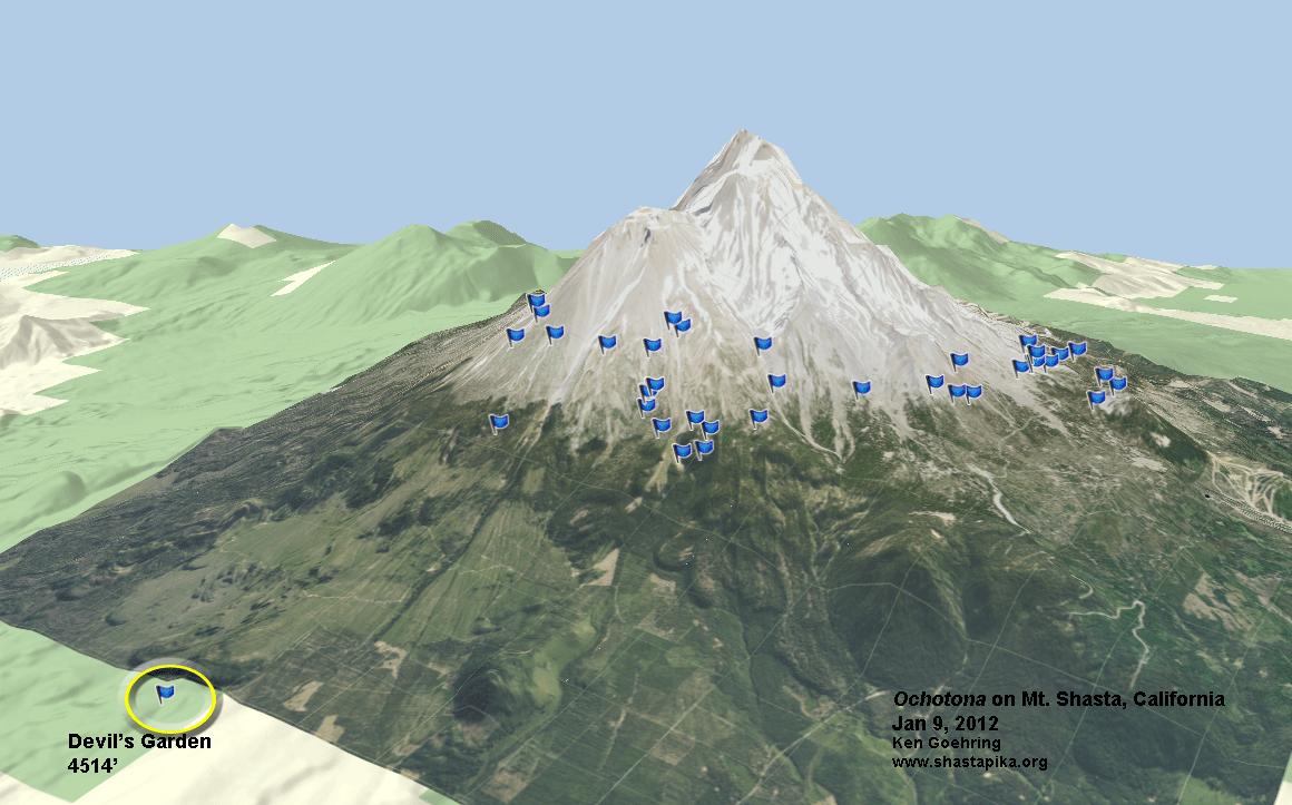
| 3-D Map of Ochotona
distribution on Mount Shasta, with Devil's Garden |
|
| Google Earth photo of site, showing coordinates | |
| Overlook
of "Devil's Garden" from trail at 4805' with the town
of Weed in the background, looking west |
|
| Photo of
upper end of Devil's Garden, looking north from Ochotona
locality showing the lava wall to the east |
|
| Photo of Ochotona site at Devil's Garden looking north | Commentary |
| Route taken
to Ochotona site at Devil's Garden |
Commentary on
route |
| Route
taken on Devil's Garden |
|
| Google
Earth photo of the Shastina lava flows, context of Devils
Garden |